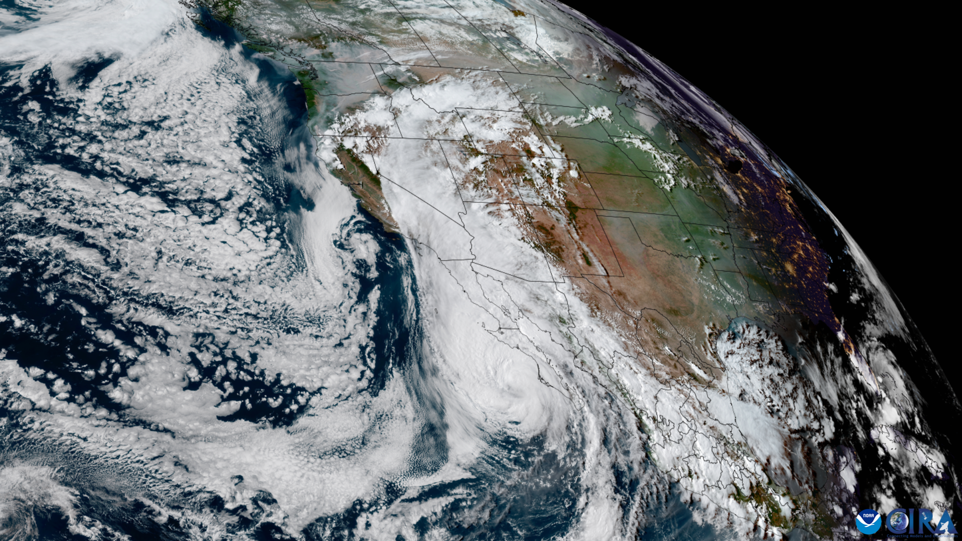
A tropical disturbance about 1,500 miles south of San Diego has a 90% chance of becoming a tropical depression within seven days, the National Hurricane Center said Monday, Aug. 31.
The system, designated Invest 95E, could strengthen into a hurricane by Sunday, Sept. 6, or Monday, Sept. 7, according to National Weather Service San Diego meteorologist Sebastian Westerink. But most weather models show the storm staying well south of California and either dissipating or moving out to sea, the San Francisco Chronicle reported.
Direct impacts remain unlikely. Fewer than 5% of model solutions support a decaying tropical cyclone reaching Southern California, the NWS San Diego office said in a Monday forecast, according to USA Today. The office said the system could bring "monsoonal moisture into portions of southern California …" by the weekend of Sept. 5.
"Whether it'll pan out something similar to what we saw with Hilary a few years ago, or whether it would just be some light rain, is uncertain right now," Westerink told the Desert Sun. "But we're definitely tracking it."
Hurricane specialist Michael Lowry said more reliable models favor the system moving out to sea rather than northward toward the coast. Even on a less likely northward track, it would arrive as a "quick-weakening tropical cyclone, not a hurricane," Lowry said.
No hurricane has ever made landfall in Southern California in modern records. The last tropical storm to do so was in 1939, according to NWS meteorologist Bryan Lewis.
The comparison on forecasters' minds is Hurricane Hilary. It weakened to a post-tropical cyclone over northern Baja California before crossing into the U.S. in August 2023. Hilary still caused nearly $1 billion in damage and catastrophic flooding across California, the Chronicle reported.
Why La Jolla is watching
Ocean temperatures are running unusually high. The sea surface temperature at the Scripps Pier hit 76.8 degrees on Friday, Aug. 28, approaching a daily record of 77 degrees set in 2015, the Los Angeles Times reported. The pier has recorded 42 record-high ocean surface temperatures so far in 2026, according to Times of San Diego.
A super El Niño is fueling those numbers. The NWS Climate Prediction Center puts the odds of a very strong El Niño this fall and winter above 90%, with sea-surface temperatures in the El Niño region 3.6 degrees above average.
Scripps coastal geologist Adam Young has said sea levels along the California coast can temporarily rise as much as 13 inches during strong El Niño events, Times of San Diego reported. Tropical storms need water temperatures of at least 80 degrees to maintain strength. Waters off California remain well below that mark.
Meanwhile, Hurricane Karina is already generating high surf along the Southern California coast. The NWS issued a Beach Hazards Statement Monday warning of dangerous rip currents and waves up to 6 feet for Ventura and Los Angeles county beaches, KTLA reported. Southerly swells are expected to continue through much of the week of Sept. 7.
San Diego Fire-Rescue crews rescued four people from submerged cars on La Jolla Village Drive during heavy rain on March 6, 2025. The department urged residents not to drive through flooded areas.
The NHC has not yet issued a formal track forecast for Invest 95E. The City of San Diego's Office of Emergency Services maintains an El Niño preparedness page at sandiego.gov/elnino with information on flood risks and emergency alerts.